


ArcGIS Flight app for iPhone and iPad
Developer: ESRI
First release : 08 Sep 2016
App size: 368.51 Mb
ArcGIS Flight makes it easy to collect images to create accurate, high-resolution maps and 3D models using drones.
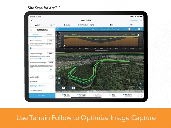
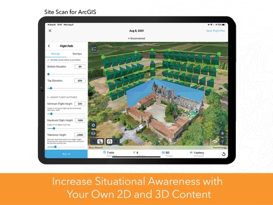
Choose from a variety of flight modes tailored to the type of site being scanned, and the app will automatically define the optimal flight path and allow you to preview it in 2D or 3D. Experienced pilots can use Terrain Follow, which enhances imagery quality by adjusting the drones height to follow the terrain.
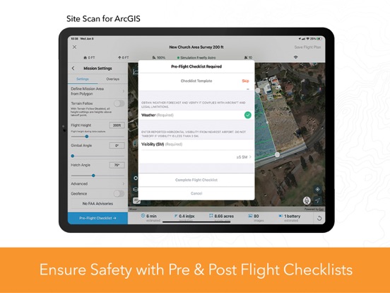
After completing your organizations custom preflight checklist, the app automatically conducts aircraft checks and executes the flight. Long flights are automatically split, allowing you to change your drone’s battery and resume where you left off. After completing the flight, wirelessly transfer the images to your iPad and upload them along with your Fleet Management information to Site Scan Manager for processing on the cloud. It is also possible to transfer the images captured during a flight for processing using ArcGIS Drone2Map or ArcGIS Pro using the ArcGIS Reality for ArcGIS Pro extension.
Compatibility:
Requires compatible drone: Freefly Astro, DJI Phantom 4 Advanced, DJI Phantom 4 Pro (v1 & v2), DJI P4 RTK, Mavic Pro, Mavic 2 Pro, M200 series, M200 series V2, Inspire 2, M300.
Check the latest documented drone matrix for supported firmware versions.
Requires an ArcGIS account with mobile worker or higher license or a Site Scan operator license.